Putting India on the map
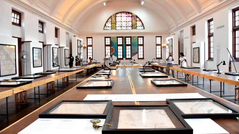
India on our Mind showcased collections of maps dating our country's civilisation, and was organised by Prashnt Lahoti.

India has always been a diverse country, with a coming together of people, culture, cuisine and history. But, this diversity didn’t just happen overnight, and all of us didn’t just come together from different parts of the globe or the country without a deeper phenomenon at play. This meeting of diverse cultures was made possible because of the ordinary map! They mapped India, gave Mahatma Gandhi and Jawaharlal Nehru a country to fight for, and here we are now, liberated and free.
This latest collection showcased at the Indian Institute of Science called ‘India on our Mind’ is art gallery owner Prashnt Lahoti’s collections of maps that were instituted to acquire, preserve, interpret and share the spread of Indian civilisation’s heritage across continents and cultures.
The exhibition started on March 19 and will go on for an entire month (April 18). A travelling show, it has already travelled to Kochi, Hyderabad and is now showcasing in Bengaluru. Prashnt Lahoti, the collector of these maps, has been collecting ancient maps for the past 16 years. He speaks of how he got interested in collecting maps in the first place, “It was a just coincidence when I walked into a shop that was selling antique maps, I liked the feel of it, and then it became a huge passion for me. One of my favourite maps from the collection is the ‘Ganga map’ because you can see so much of a reflection of art in it, and it depicts the Holy Ganga and its sanctity. I found this map from a country outside India. It’s like a dream come true to do this show in such an esteemed institute like the IISC. When we showcased it in Delhi, our audience was different and I’m sure here it is going to be different too.”
These maps will just be maps, but to put them together and bring the arts and maps to life, while telling a story is something Siddhartha Chatterjee, the designer for the exhibit enthused in. He says, “It’s been interesting dealing with a new creative bunch of people, putting this show up for the third time. It’s indeed a wonderful setting to display these historic maps and paintings; the hall here allows you to bring out the best of the scale of these objects. A thematically and tightly curated show that has collections that date from the more recent 20th-century works that ISRO and the postal department is doing, it includes a whole spectrum.”
Many in the faculty from IISC have been involved in putting this show together. One of them is Dr Uday Balakrishnan, a visiting faculty at the Centre for Contemporary Studies in IISC says, “The whole concept of the exhibition is to show India as Indian’s saw themselves, and as foreigners saw India. In a few days, we will have photographs of India and Asia from space. There are three aspects to this cause — we want to show how India really came together. From an idea, you see how India was mapped and then after it was mapped, we have a country to look at, and say this is ours and we fought for it.”
Anurag Kumar, the Director of IISC says, “What I understand is that these maps have been collected over many years, and they represent the evolution of the mapping of India, right from the early days during the pre- European era, until now. All the occupants of countries like the Portuguese, Dutch, French and English have played a role in mapping the country and you see the example of the maps displayed here. It is a very historical and valuable collection.”
