Beyul lakes grow after landslides

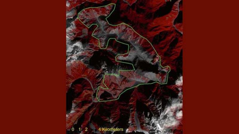
New Delhi: The landslides caused by a 6.4 Richter scale earthquake on November 17 in one of earth’s most forbidding and inaccessible regions in the ‘mystical’ land of Beyul Pemako near the India-China border has resulted in massive landslides that are still continuing with the slide area increasing to at least 78 sq km as on December 21 shown in the imagery by LANDSAT-8, a satellite jointly operated by NASA and the United States Geological Survey (USGS).
After a perusal of the LANDSAT-8 imagery of the Gyala Peri-Namcha Barwa gorge taken by the US LANDSAT-8, Prof Nayan Sharma, a prominent river engineering expert presently with IIT Roorkee, told this newspaper: “The area of the prime mountain slide zone is measured to be approximately 78 sq km as extracted from the satellite imagery. This slide zone is relatively close to eastern Tibet major tourist city of Nyingchi at a distance of 139 km downstream.”
“From an inspection of multi-date satellite images of the affected zone, it could be inferred that the landslide process resulting in debris dam growth is yet to reach its final equilibrium stable state. This is a worrisome occurrence, especially pertaining to potential debris dam breach flood in coming days or months with serious portents for downstream habitation areas in eastern Tibet, Arunachal Pradesh and Assam”, he said adding that the major mountain slide zone extends over a river length of about 33 km which is located about 47 km away from the commencement of Yarlung Tsangpo Grand Canyon.
Beyul Pemako is believed to nestle the mythical land of Shangri La or paradise in Tibetan Buddhism.

