Hyderabad: Varying data on lake helped encroachers

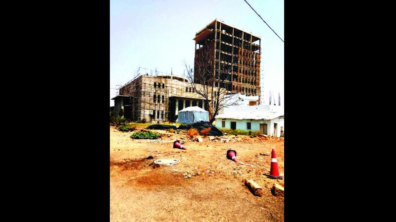
Hyderabad: Suram Cheruvu at Bandlaguda in the Old City, near where a 14-storey building is coming up, is falling victim to contradictory data with different departments with regard to its spread.
As per revenue records, the lake spreads over 48.21 acres in Survey No. 62 of Bandlaguda Khalsa village in Bandlaguda Mandal. But one Mr Shankaraiah, allegedly a benami of a prominent politician, refilled a part of it and began construction of the building. Following this, a few others began construction of independent houses and commercial complexes.
The Primary Fishermen Cooperative Marketing Society Limited has been fighting against encroachers since 2013 and filed a public interest litigation in the High Court in 2015. The court barred any construction within the Full Tank Level of Suram Cheruvu.
Also in 2013, a petitioner, Mr E. Shankaraiah, had filed a written petition with the High Court on the same issue on the basis of a judgement given in 2001. That case is still pending.
On June 1, the court asked the Hyderabad collector why the revenue department had not followed the court’s orders and demolished the building. Revenue officials said data in the records available with the HMDA, revenue, irrigation, survey and town planning departments differed.
Congress leader Mohammad Ali Shabbir said the government was remaining silent on encroachments in the Old City. “Politicians are behind the land grabbing in Suram Cheruvu. Why did the government officials not discover the encroachment till the 14-storey building was built,” he asked.
Hyderabad collector Rahul Bojja said the builder had a status quo order. He said the administration had prepared a counter-affidavit and sent it to the Advocate General. We are waiting to get the court’s permission.
In-charge revenue divisional officer, Hyderabad, K. Chandra Kala said the problem arose because of the conflicting records. The lake was listed in Survey No. 62 in Bandlaguda. Encroachers mentioned sub-parts in their representation to the court.
“Encroachers mentioned Surveys No. 62/1, 62/2 etc and we objected to this in court. But the documents with other departments supported their documents. We are waiting for the court's directions,” she said.
Lake under contradiction
- Land records with the HMDA, revenue, irrigation, survey and town planning departments have conflicting information.
- GHMC survey of nalas and encroachments had led to controversies due to the contradictory data.
- Land grabbers use the conflicting data to get injunction or status-quo orders from the courts.
- In Suram Cheruvu, revenue records say that the water body belongs to the government. Records with HMDA and the irrigation department show there are parts in Survey No. 62.

