Telangana: Monuments to be mapped, measured

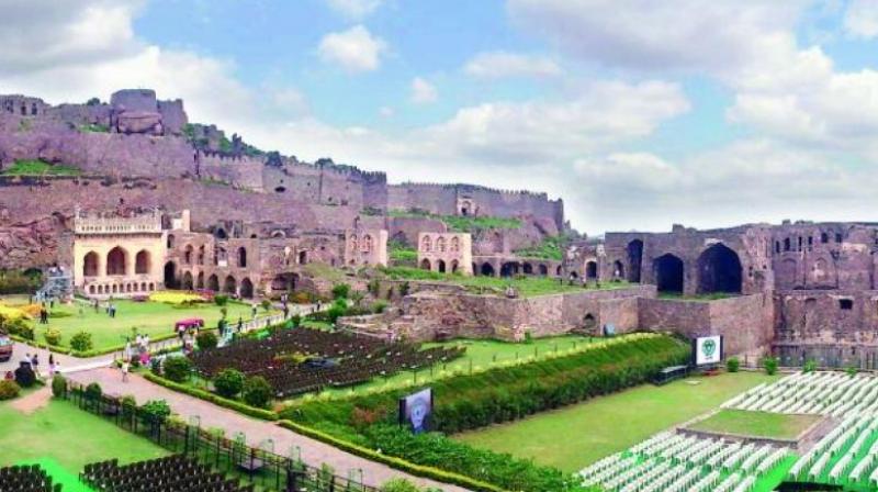
Hyderabad: The Golconda fort in Hyderabad, the Penukonda fort and northern gateway, the lower and upper forts of Chandragiri in Chittoor district are among the monuments that will be mapped, measured, site plan prepared and boundaries fixed. Though on paper the monuments have huge tracts of lands, the boundary points of them many have been vanished due to gradual encroachments, sources told this newspaper.
The Archaeological Survey of India puts the Golconda fort area as 788 acres. The original fort wall had a circumference of 7 km. Over the last four centirues. several parts of the fort, said to be the largest in the Deccan plateau, has been encroached. The Archaeological Survey of India is also geo-tagging several monuments across the nation in an attempt to provide information at a glance for tourists.
Following are the monuments:
778 acres: Golconda fort (Hyderabad)
155.55 acres: Penukond afort and northern gateway, Anantapur district
352.82 acres: Chandragiri lower and upper forts, Chittoor district
98.59 acres: Mangapuram Venkateswara Vishnu temple, Chittoor district
107.96 acres: Nandaluru Saumyanatha temple, Kadapa district
232.25 acres: Sidhout fort, buildings, Kadapa district
93.64 acres: Sivalpalle Visvanathaswami temple, Kadapa district
114.58 acres: Vontimitta Sri Kodandarama Swami temple, Kadapa district
145 acres: Adoni fort, buildings, Kurnool district
150.76 acres: Yaganti old cave temple, Uma Maheshwara Swami temple, Kurnool district
125.47 acres: Samalkot Bhimeswara temple, East Godavari district
97.05 acres: Buddhist remains in a mound at Ghantasala, Krishna district
529.55 acres: Mogalraj-puram: Rock-cut cave temples, Krishna district
100.95 acres: Vijayawada Akkanna Madanna cave complex, Krishna district
101.8 acres: Chejerla Kapoteswara temple, Guntur district
101.99 acres: Bapatla Sri Bhavanarayana Swami temple, Guntur district.

