Cyclone Remal to cross Bangladesh and WB Coasts tomorrow evening

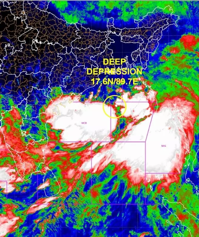
New Delhi: India Meteorological Department (IMD) on Saturday informed that the depression over east central Bay of Bengal moved northeast wards with a speed of 15 kmph during the past few hours on Saturday and intensified into a deep depression and lay over east central Bay of Bengal about 490 km south Khepupara, Bangladesh and about 380 km south-southeast of Sagar Islands, West Bengal.
In its tropical weather outlook report released on Saturday, the cyclone Remal was likely to move nearly northwards and intensify into a cyclonic storm over east central and adjoining north Bay of Bengal. It is likely to continue to move nearly northwards and intensify into a severe cyclonic storm over northwest and adjoining northeast Bay of Bengal on May 26 and continue to move nearly northwards.
Thereafter, it is likely to cross Bangladesh and adjoining West Bengal coasts between Sagar Island and Khepupara between 4 pm and 6 pm Universal Time Coordinated (UTC) on May 26 as a severe cyclonic storm with a wind speed of 110-120 gusting to 135 kmph, according to Arulalan T, Scientist C, IMD, New Delhi.
On Friday, the National Crisis Management Committee (NCMC) met under the chairmanship of Cabinet Secretary Rajiv Gauba and reviewed preparedness for the impending cyclone in Bay of Bengal.
The Director General, India Meteorological Department (IMD), briefed the Committee about the current status of the depression over central Bay of Bengal, about 800 km south-southwest of Khepupara (Bangladesh) and 810 km south of Canning (West Bengal).

